A Renewed Approach to the ABC Landscape Assessment Method: An Application to Muntanyes d’Ordal, Barcelona Metropolitan Area
DOI:
https://doi.org/10.3097/LO.201856Keywords:
Landscape, landscape method, landscape chorology, landscape taxonomy, Muntanyes d’OrdalAbstract
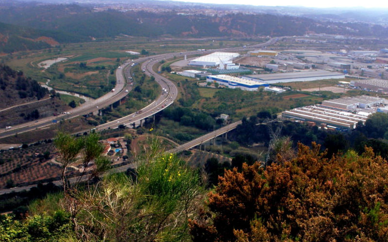
The aim of this paper is to describe a renewed approach to the ABC landscape assessment method, a procedure that undertakes landscape approach considering abiotic (A), biotic (B) and cultural (C) elements shaping the landscape. This new method is organized in three nested multi-scaled levels defined with high accuracy (1:10,000; 1:20,000; 1:25,000), it combines holistic and parametric approaches and it delineates landscape units from both a typological and chorological point of view. The procedure is based on field work, congruently integrates physical, cultural and perceived landscape components and focuses on the spatial dimension of landscape. Landscape units are hierarchised and classified, leading to a landscape taxonomy. An example is given for Muntanyes d’Ordal, in the Barcelona metropolitan area, with 36 units and 1,019 delineations at Level I, 8 units and 74 delineations at Level II and 14 units at Level III. Overall, 42.5% of Level I delineations are defined by biotic elements and 32.4% by anthropic elements, which shows the peri-urban nature of the area studied. The main interest and originality of the method lies in the fact that the holistic and parametric approaches are integrated using a systematic procedure that can be easily replicated anywhere so that results from different areas can be compared.
References
Balestrieri, M. (2015). Theories and methods of rural landscape classification in europe: The italian approach. International Journal of Rural Management, 11(2), 156-174. doi:10.1177/0973005215604932
Bastian, O. (2000). Landscape classification in saxony (germany) - A tool for holistic regional planning. Landscape and Urban Planning, 50(1-3), 145-155. doi:10.1016/S0169-2046(00)00086-4
Bolós, M. (1992). Manual de ciencia del paisaje. Manual De Ciencia Del Paisaje,
Bolòs, M., & Bofarull, J. (2007). Els mapes d'unitats de paisatge. Proceedings of the 1stNational Seminar on Landscape in Andorra, Andorra La Vella,
Brunetta, G., & Voghera, A. (2008). Evaluating landscape for shared values: Tools, principles, and methods. Landscape Research, 33(1), 71-87. doi:10.1080/01426390701773839
Dollfus, O. (1970). L'Espace Géographique,
Drǎguţ, L., & Eisank, C. (2012). Automated object-based classification of topography from SRTM data. Geomorphology, 141-142, 21-33. doi:10.1016/j.geomorph.2011.12.001
Griffiths, G. H., Porter, J., Simmons, E., & Warnock, S. (2004). The living landscapes project: Landscape character and biodiversity final report. The Living Landscapes Project: Landscape Character and Biodiversity,
Jongman, R. H. G., Bunce, R. G. H., Metzger, M. J., Mücher, C. A., Howard, D. C., & Mateus, V. L. (2006). Objectives and applications of a statistical environmental stratification of europe. Landscape Ecology, 21(3 SPEC. ISS.), 409-419. doi:10.1007/s10980-005-6428-0
Leitao, A. B., Miller, J., Ahern, J., & McGarigal, K. (2006). Measuring Landscapes: A Planner's Handbook,
Mezősi, G., Csorba, P., Bata, T., Blanka, V., & Ladányi, Z. (2016). Similarity assessment of natural landscapes based on taxonomic distance. Applied Ecology and Environmental Research, 14(3), 679-693. doi:10.15666/aeer/1403_679693
Mitchell, C. W. (1991). Terrain Evaluation,
Mücher, C. A., Bunce, R. G. H., Jongman, R. H. G., Klijn, J. A., Koomen, A. J. M., Metzger, M. J., & Wascher, D. M. (2003). Identification and characterisation of environments and landscapes in europe. Identification and Characterisation of Environments and Landscapes in Europe,
Mücher, C. A., Klijn, J. A., Wascher, D. M., & Schaminée, J. H. J. (2010). A new european landscape classification (LANMAP): A transparent, flexible and user-oriented methodology to distinguish landscapes. Ecological Indicators, 10(1), 87-103. doi:10.1016/j.ecolind.2009.03.018
Rougerie, G., & Beroutchachvili, N. (1991). Géosystèmes et paysages. Géosystèmes Et Paysages,
Serrano Giné, D. (2014). Mapping geomorphological values from a landscape perspective. Journal of Maps, 10(4), 554-562. doi:10.1080/17445647.2014.892035
Slocum, T. A. (1999). Thematic Cartography and Visualization,
Swanwick, C. (2002). Landscape Character Assessment: Guidance for England and Scotland,
Tudor, C. (2014). An approach to landscape character assessment. An Approach to Landscape Character Assessment,
Tveit, M., Ode, Å., & Fry, G. (2006). Key concepts in a framework for analysing visual landscape character. Landscape Research, 31(3), 229-255. doi:10.1080/01426390600783269
Vacca, A., Loddo, S., Melis, M. T., Funedda, A., Puddu, R., Verona, M., . . . Schirru, P. (2014). A GIS based method for soil mapping in sardinia, italy: A geomatic approach. Journal of Environmental Management, 138, 87-96. doi:10.1016/j.jenvman.2013.11.018
Vallés, M., Galiana, F., & Bru, R. (2013). Towards harmonisation in landscape unit delineation: An analysis of spanish case studies. Landscape Research, 38(3), 329-346. doi:10.1080/01426397.2011.647896
Van Eetvelde, V., & Antrop, M. (2009). A stepwise multi-scaled landscape typology and characterisation for trans-regional integration, applied on the federal state of belgium. Landscape and Urban Planning, 91(3), 160-170. doi:10.1016/j.landurbplan.2008.12.008
Wascher, D. M. (2005). European landscape character areas: Typologies, cartography and indicators for the assessment of sustainable landscapes. European Landscape Character Areas - Typologies, Cartography and Indicators for the Assessment of Sustainable Landscapes,
Zonneveld, I. S. (1995). Land Ecology: An Introduction to Landscape Ecology as a Base for Land Evaluation, Land Management and Conservation,

Downloads
Published
How to Cite
Issue
Section
License
Copyright (c) 2019 David Serrano Giné

This work is licensed under a Creative Commons Attribution 4.0 International License.


