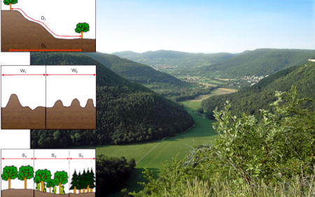
Effects of topography and surface roughness in analyses of landscape structure - A proposal to modify the existing set of landscape metrics
DOI:
https://doi.org/10.3097/LO.200803Keywords:
Digital elevation models, Neutral landscapes, Patch-corridor-matrix model, Relief, Roughness parametersAbstract
Topography and relief variability play a key role in ecosystem functioning and structuring. However, the most commonly used concept to relate pattern to process in landscape ecology, the so-called patch-corridor-matrix model, perceives the landscape as a planimetric surface. As a consequence, landscape metrics, used as numerical descriptors of the spatial arrangement of landscape mosaics, generally do not allow for the examination of terrain characteristics and may even produce erroneous results, especially in mountainous areas. This brief methodological study provides basic approaches to include relief properties into large-scale landscape analyses, including the calculation of standard landscape metrics on the basis of "true" surface geometries and the application of roughness parameters derived from surface metrology. The methods are tested for their explanatory power using neutral landscapes and simulated elevation models. The results reveal that area and distance metrics possess a high sensitivity to terrain complexity, while the values of shape metrics change only slightly when surface geometries are considered for their calculation. In summary, the proposed methods prove to be a valuable extension of the existing set of metrics mainly in "rough" landscape sections, allowing for a more realistic assessment of the spatial structure.
References
Bailey, R. G. (2004). Role of Landform in Differentiation of Ecosystems at the Mesoscale,
Beasom, S. L., Wiggers, E. P., & Giardino, J. R. (1983). A technique for assessing land surface ruggedness. Journal of Wildlife Management, 47(4), 1163-1166.
Bennett, A. F. (1999). Linkages in the Landscape: The Role of Corridors and Connectivity in Wildlife Conservation,
Blaschke, T., & Drǎguţ, L. (2003). Integration of GIS and object-based image analysis to model and visualize landscapes. ISPRS Workshop, , 18-23.
Blaschke, T., Tiede, D., & Heurich, M. (2004). 3D landscape metrics to modelling forest structure and diversity based on laser scanning data. International Archives of Photogrammetry, Remote Sensing and Spatial Information Sciences, 36(8 W2), 129-132.
Blaszczynski, J. S. (1997). Landform characterization with geographic information systems. Photogrammetric Engineering and Remote Sensing, 63(2), 183-191.
Bolstad, P. V., Swank, W., & Vose, J. (1998). Predicting southern appalachian overstory vegetation with digital terrain data. Landscape Ecology, 13(5), 271-283. doi:10.1023/A:1008060508762
Burnett, M. R., August, P. V., Brown Jr., J. H., & Killingbeck, K. T. (1998). The influence of geomorphological heterogeneity on biodiversity: I. A patch-scale perspective. Conservation Biology, 12(2), 363-370. doi:10.1046/j.1523-1739.1998.96238.x
Chen, J. -. (2003). Dijkstra's shortest path algorithm. Journal of Formalized Mathematics, 11(3), 237-247.
Cormen, T. H., Leiserson, C. E., & Rivest, R. L. (1990). Introduction to Algorithms,
Couteron, P., Barbier, N., & Gautier, D. (2006). Textural ordination based on fourier spectral decomposition: A method to analyze and compare landscape patterns. Landscape Ecology, 21(4), 555-567. doi:10.1007/s10980-005-2166-6
Davis, F. W., & Goetz, S. (1990). Modeling vegetation pattern using digital terrain data. Landscape Ecology, 4(1), 69-80. doi:10.1007/BF02573952
Dikau, R., & Schmidt, J. (1999). Georeliefklassifikation. Angewandte Landschaftsökologie, , 217-244.
Dorner, B., Lertzman, K., & Fall, J. (2002). Landscape pattern in topographically complex landscapes: Issues and techniques for analysis. Landscape Ecology, 17(8), 729-743. doi:10.1023/A:1022944019665
Drǎguţ, L., & Blaschke, T. (2006). Automated classification of landform elements using object-based image analysis. Geomorphology, 81(3-4), 330-344. doi:10.1016/j.geomorph.2006.04.013
Ernoult, A., Bureau, F., & Poudevigne, I. (2003). Patterns of organisation in changing landscapes: Implications for the management of biodiversity. Landscape Ecology, 18(3), 239-251. doi:10.1023/A:1024457031235
Evans, I. S. (2019). General geomorphometry, derivatives of altitude, and descriptive statistics. Spatial analysis in geomorphology (pp. 17-90) doi:10.4324/9780429273346-2
Fahrig, L. (1997). Relative effects of habitat loss and fragmentation on population extinction. Journal of Wildlife Management, 61(3), 603-610. doi:10.2307/3802168
Forman, R. T. T. (1995). Land Mosaics: The Ecology of Landscapes and Regions,
Gardner, R. H., Milne, B. T., Turnei, M. G., & O'Neill, R. V. (1987). Neutral models for the analysis of broad-scale landscape pattern. Landscape Ecology, 1(1), 19-28. doi:10.1007/BF02275262
Gardner, R. H., & Urban, D. L. (2007). Neutral models for testing landscape hypotheses. Landscape Ecology, 22(1), 15-29. doi:10.1007/s10980-006-9011-4
Jenness, J. S. (2004). Calculating landscape surface area from digital elevation models. Wildlife Society Bulletin, 32(3), 829-839. doi:10.2193/0091-7648(2004)032[0829:CLSAFD]2.0.CO;2
Krauss, J., Steffan-Dewenter, I., Müller, C. B., & Tscharntke, T. (2005). Relative importance of resource quantity, isolation and habitat quality for landscape distribution of a monophagous butterfly. Ecography, 28(4), 465-474. doi:10.1111/j.0906-7590.2005.04201.x
Lang, S., & Tiede, D. (2003). vLATE extension für ArcGIS − vektorbasiertes tool zur quantitativen landschaftsstrukturanalyse ESRI anwenderkonferenz 2003 innsbruck CDROM. VLATE Extension Für ArcGIS - Vektorbasiertes Tool Zur Quantitativen Landschaftsstrukturanalyse,
Lefsky, M. A., Cohen, W. B., Parker, G. G., & Harding, D. J. (2002). Lidar remote sensing for ecosystem studies. Bioscience, 52(1), 19-30. doi:10.1641/0006-3568(2002)052[0019:LRSFES]2.0.CO;2
Li, X., He, H. S., Wang, X., Bu, R., Hu, Y., & Chang, Y. (2004). Evaluating the effectiveness of neutral landscape models to represent a real landscape. Landscape and Urban Planning, 69(1), 137-148. doi:10.1016/j.landurbplan.2003.10.037
McGarigal, K. (2002). Landscape pattern metrics. Encyclopedia of Environmentrics, 2, 1135-1142.
McGarigal, K., & Cushman, S. A. (2005). The gradient concept of landscape structure. Issues and perspectives in landscape ecology (pp. 112-119) doi:10.1017/CBO9780511614415.013
McGarigal, K., Cushman, S. A., Neel, M. C., & Ene, E. (2002). FRAGSTATS: Spatial pattern analysis program for categorical maps. FRAGSTATS: Spatial Pattern Analysis Program for Categorical Maps,
McGarigal, K., & Marks, B. J. (1995). FRAGSTATS: Spatial pattern analysis program for quantifying landscape structure. FRAGSTATS: Spatial Pattern Analysis Program for Quantifying Landscape Structure,
McNab, W. H. (1993). A topographic index to quantify the effect of mesoscale landform on site productivity. Canadian Journal of Forest Research, 23(6), 1100-1107. doi:10.1139/x93-140
Oke, T. R. (1987). Boundary Layer Climates,
Perera, A. H., Baldwin, D. J. B., & Schnekenburger, F. (1997). LEAP II: A landscape ecological analysis package for land use planners and managers. Forest Research Report no.146,
Pike, R. J. (2000). Geomorphometry - diversity in quantitative surface analysis. Progress in Physical Geography, 24(1), 1-20. doi:10.1191/030913300674449511
Saunders, S. C., Chen, J., Drummer, T. D., Gustafson, E. J., & Brosofske, K. D. (2005). Identifying scales of pattern in ecological data: A comparison of lacunarity, spectral and wavelet analyses. Ecological Complexity, 2(1), 87-105. doi:10.1016/j.ecocom.2004.11.002
Saura, S., & Martínez-Millan, J. (2000). Landscape patterns simulation with a modified random clusters method. Landscape Ecology, 15(7), 661-678. doi:10.1023/A:1008107902848
Sebastiá, M. -. (2004). Role of topography and soils in grassland structuring at the landscape and community scales. Basic and Applied Ecology, 5(4), 331-346. doi:10.1016/j.baae.2003.10.001
Stout, K. J., Sullivan, P. J., Dong, W. P., Mainsah, E., Luo, N., Mathia, T., & Zahouani, H. (1993). The Development of Methods for the Characterisation of Roughness in Three Dimensions,
Swanson, F. J., Kratz, T. K., Caine, N., & Woodmansee, R. G. (1988). Landform effects on ecosystem patterns and processes. Bioscience, 38(2), 92-98.
Turner, M. G. (1989). Landscape ecology: The effect of pattern on process. Annual Review of Ecology and Systematics.Vol.20, , 171-197. doi:10.1146/annurev.es.20.110189.001131
van Dorp, D., & Opdam, P. F. M. (1987). Effects of patch size, isolation and regional abundance on forest bird communities. Landscape Ecology, 1(1), 59-73. doi:10.1007/BF02275266
Walz, U., Hoechstetter, S., & Thinh, N. X. (2007). Daten und methoden zur analyse von dreidimensionalen landschaftsstrukturen. PFG, 4(2007), 225-238.
Wiens, J. A., Stenseth, N. C., Van Horne, B., & Ims, R. A. (1993). Ecological mechanisms and landscape ecology. Oikos, 66(3), 369-380. doi:10.2307/3544931
Wilson, J. P., & Gallant, J. C. (2000). Terrain Analysis: Principles and Applications,
Wood, J. (2005). LandSerf,
Zonneveld, I. S. (1989). The land unit - A fundamental concept in landscape ecology, and its applications. Landscape Ecology, 3(2), 67-86. doi:10.1007/BF00131171

Downloads
Published
How to Cite
Issue
Section
License
Copyright (c) 2019 Sebastian Hoechstetter, Ulrich Walz, Le Hai Dang, Nguyen Xuan Thinh

This work is licensed under a Creative Commons Attribution 4.0 International License.


